Post by : Mumtaaz Qadiri
The Sultanate of Oman joined an important United Nations meeting called the 15th session of the Committee of Experts on Global Geospatial Information Management, or UN-GGIM for short. This meeting was held at the UN headquarters in New York, USA. Many countries and experts from around the world came together to talk about geospatial information. Geospatial information is data related to places on Earth, like maps or satellite images. It helps countries make good decisions about land, resources, and development.
Omani Leaders Represented the Country at the Meeting
Oman sent a group of experts to this meeting. The team was led by the Acting Chairman of the National Survey and Geospatial Information Authority. This authority is part of Oman’s Ministry of Defence. Their job is to collect, manage, and use geospatial data. Having experts at this meeting shows Oman’s strong interest in using location data to support its development and security.
What Is Geospatial Data and Why It Matters
Geospatial data means any information that shows the location or position of things on Earth. This can be anything from maps showing roads, cities, and forests, to satellite pictures of weather patterns or natural disasters. Governments and businesses use geospatial data to plan cities, protect the environment, and respond to emergencies. The UN meeting focused on how to improve how this data is managed and shared around the world.
Improving Rules and Systems for Geospatial Data Use
One important topic at the meeting was about improving governance frameworks. Governance means the rules, policies, and systems that control how geospatial data is collected, stored, and used. Good governance ensures the data is accurate, secure, and shared properly. This helps countries trust each other’s data and use it to work together on big issues like climate change and sustainable development.
How Regional Groups Help Build Global Plans
The meeting also discussed the role of regional committees. Different parts of the world have their own groups working on geospatial data. For example, Africa, Asia, Europe, and other regions have committees that focus on their local needs. These regional groups share their knowledge and data with the global community. This way, local information helps build better global plans for managing geospatial data.
Thematic Networks Help With Specific Geospatial Projects
Another important part of the meeting was about thematic networks. These are groups that focus on specific topics, such as disaster management, health, or environment. They use geospatial data to solve problems in their fields. For example, a network might use maps to help track disease outbreaks or manage natural disasters. These networks make geospatial information more useful and focused on real-world needs.
Talking About the Future of Geospatial Systems
The experts also talked about the future of geospatial information ecosystems. An ecosystem is like a system made up of many parts working together. In this case, it means the collection of tools, technology, data, and people involved in managing geospatial information. The goal is to make these systems more connected and advanced so they can better serve countries and people worldwide.
Important Items on the Meeting Agenda
Many important topics were discussed during the meeting. One was the United Nations Integrated Geospatial Information Framework, or IGIF. This framework is a guide to help countries build strong and reliable geospatial information systems. Another important topic was the Global Geodetic Reference Frame (GGRF). This is a very precise system used to measure locations and heights anywhere on Earth, which is key for accurate maps and navigation.
Using Geospatial Data to Help Development and the Environment
The meeting also focused on how geospatial data can help achieve sustainable development. Sustainable development means growing and improving societies in a way that does not harm the environment or future generations. For example, geospatial data can help plan cities better, protect forests, or manage water resources. It can also support climate action by helping countries understand and respond to climate change.
Laws and Policies to Manage Geospatial Data
The experts talked about the need for good legal and policy frameworks. These are laws and rules that guide how geospatial data should be collected, shared, and used safely and fairly. Clear laws help protect privacy and security, and encourage countries to share data openly. This makes geospatial information more useful for everyone.
Managing Reference Data and New Technologies
Reference data is the basic, important data needed for all geospatial work, such as country borders or city locations. The meeting looked at ways to manage this data carefully to keep it reliable. Experts also discussed new technologies, like better satellites, sensors, and data processing tools. These technologies improve the quality and use of geospatial information.
The Importance of Global Standards for Geospatial Data
Another big topic was about global standards. Standards are agreed rules that help make sure geospatial data from different countries can work together. When countries follow the same standards, it is easier to share and use data across borders. This helps with international projects and global efforts like disaster response or climate monitoring.
UN Centers Supporting Global Data Management
The meeting also reviewed the work of UN Global Geospatial Information Management Centers. These centers are based in different countries outside the main UN headquarters. They help countries by sharing expertise, providing training, and supporting projects that improve geospatial data management worldwide.
How the Meeting Fits Into UN Goals
This session was organized under the rules of the UN General Assembly and the Economic and Social Council. These are important UN groups that make decisions on international cooperation. The meeting was part of their efforts to support better use of geospatial data for the benefit of all countries.
Why This Meeting Matters for Oman and the World
For Oman, participating in this meeting shows its commitment to using modern technology and data to support national growth and global cooperation. The knowledge gained helps Oman improve its own geospatial systems and contribute to international projects.
Globally, meetings like this help countries share ideas and work together on big challenges such as climate change, disaster management, and sustainable development. Geospatial information is a powerful tool to understand and manage our planet better.
Geospatial data management


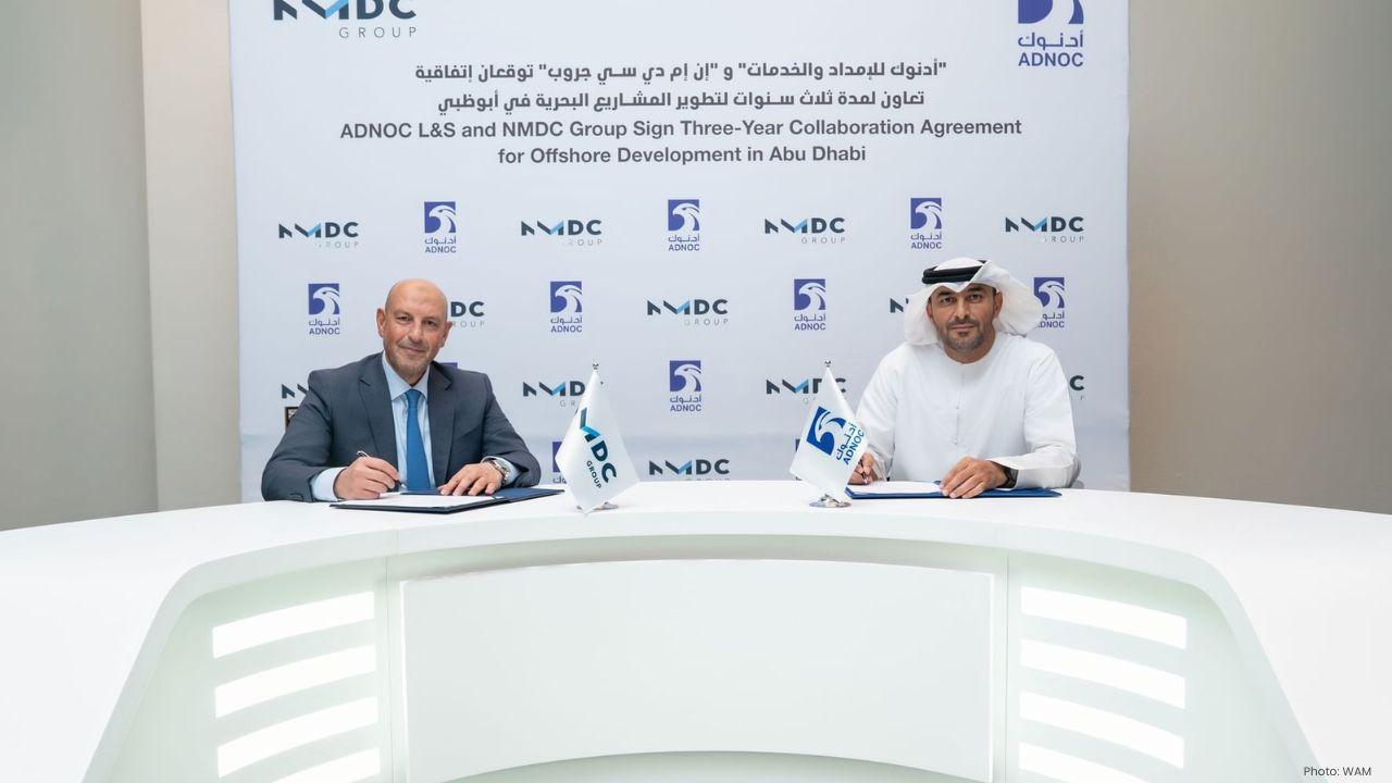
NMDC Group And ADNOC L&S Sign Three-Year Deal For Offshore Work
NMDC Group and ADNOC Logistics & Services sign a three-year deal to deliver maritime services for of
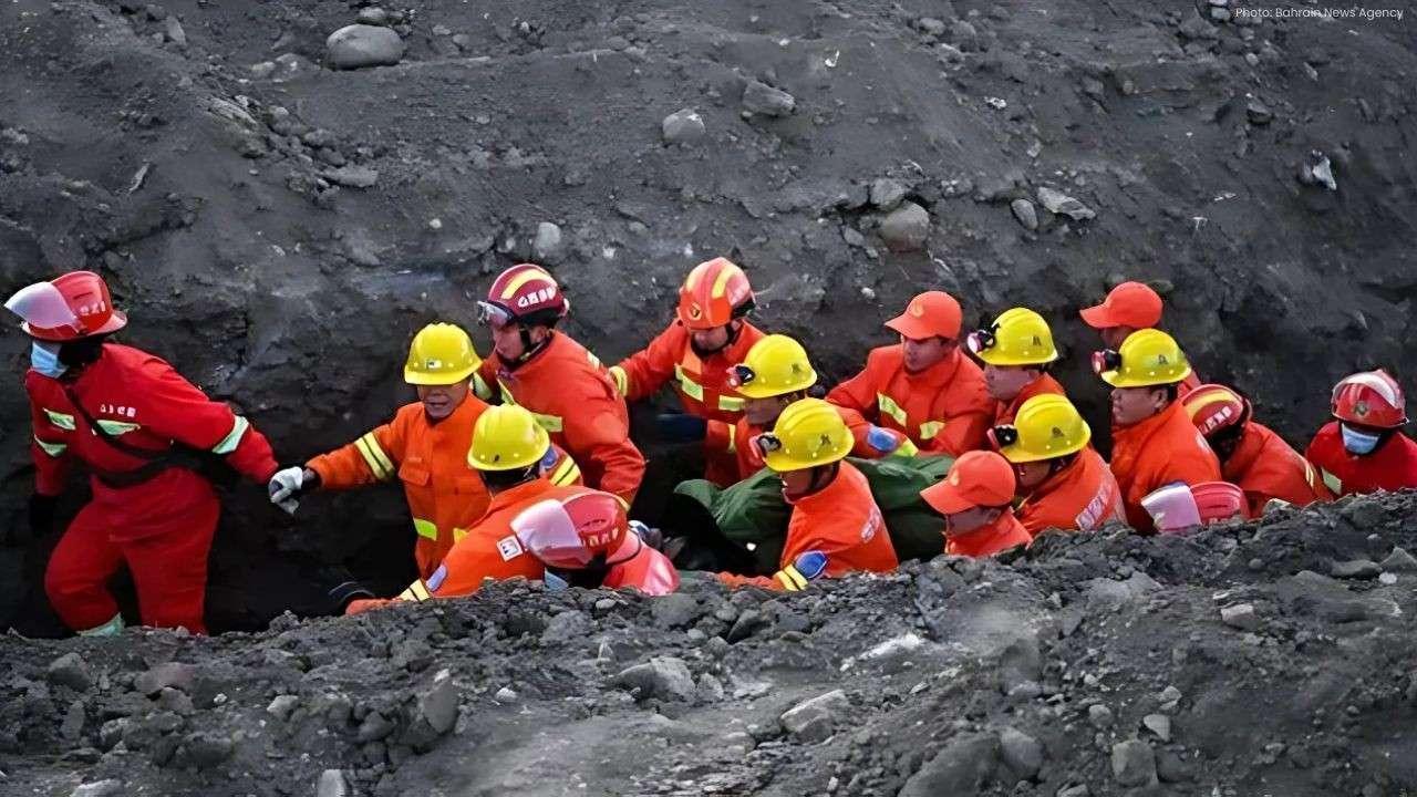
Six Miners Trapped After Earthquake Hits Coal Mine In China
A mining-related earthquake struck a coal mine in Heilongjiang, China, trapping six miners undergrou
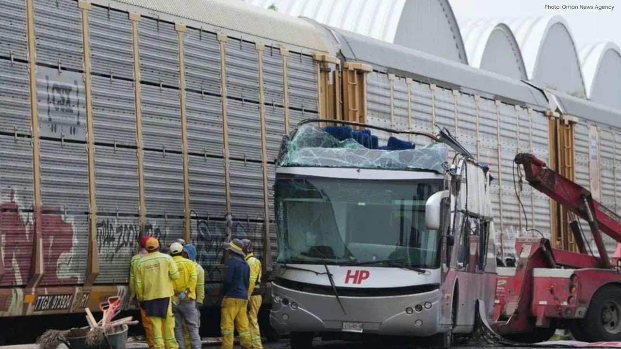
Train Collides With Bus In Mexico Killing 10 And Injuring Many
At least 10 dead and 41 injured after a train hit a bus at a rail crossing in Mexico. Authorities co

UAE Olympic Football Team Qualifies For AFC U-23 Asian Cup Finals
UAE Olympic football team qualifies for AFC U-23 Asian Cup finals in Saudi Arabia despite 3-2 loss t

Apple Launches iPhone Air With Thinnest Design & Pro Performance
Apple unveils the new iPhone Air, its thinnest model with pro performance, multiple colors, large st

Al Wakrah Wins French Arabian Breeders’ Challenge Sprint Again
Al Wakrah, trained by Jean de Mieulle, wins French Arabian Breeders’ Challenge Sprint in France, mar